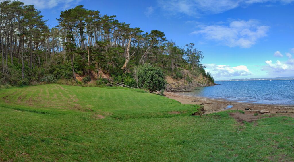
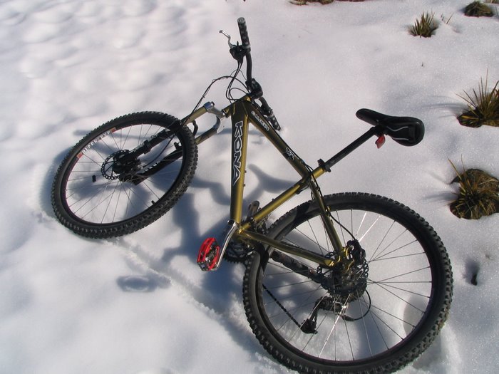
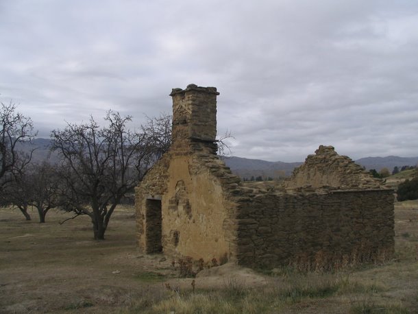
We’ve been admiring the bay from the Hobsonville ferry for the last couple of years as we have passed. Finially we got around to visiting this North Shore gem on the inner harbour.
Fitzpatric Bay from the Hobsonville Ferry
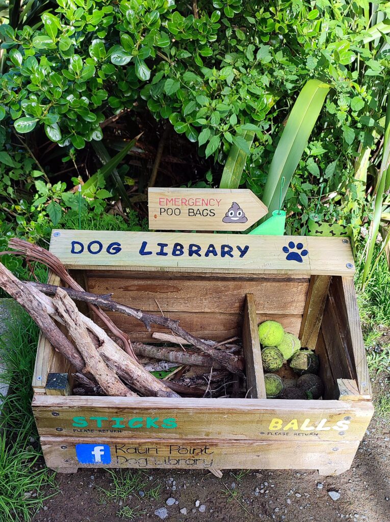
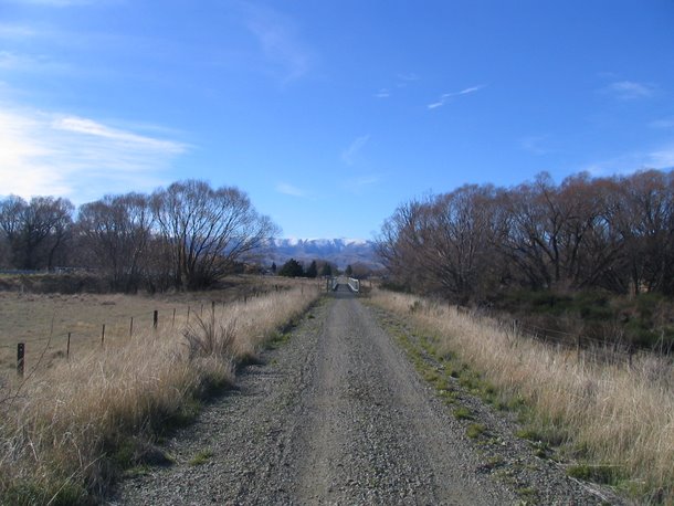
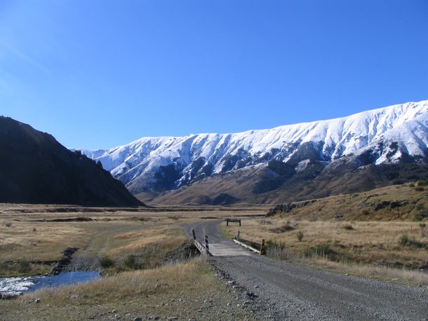
The track to the bay starts at the end of Balmain Road, Birkenhead. A handy dog library too!
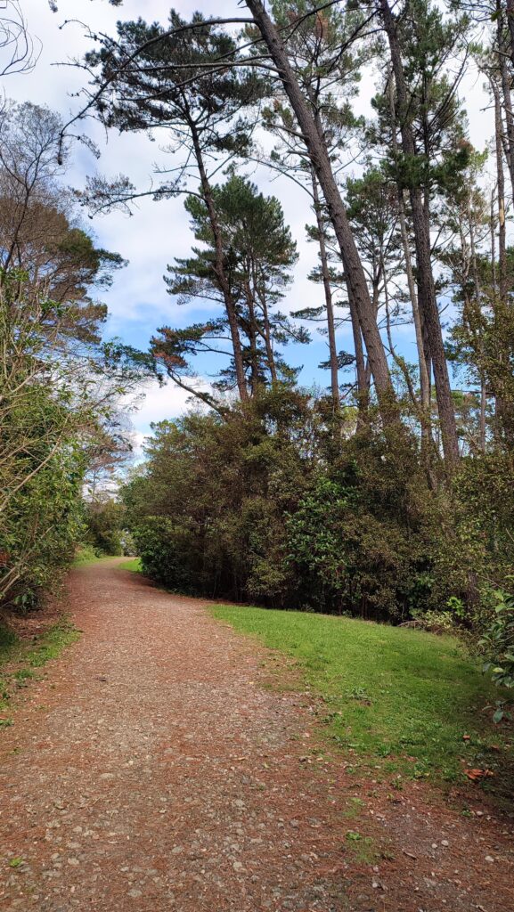
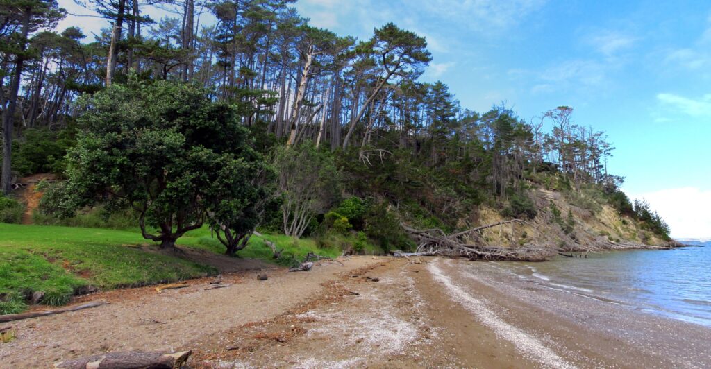
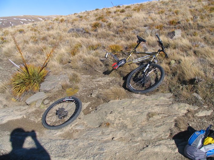
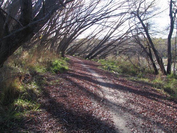
The track is pretty good, with crushed concrete and rubble being the main material. A bit rough in jandals. After a few minutes a side track branches off to the right – it goes down to the edge of the mangroves at Soldiers Bay and a small high tide beach.
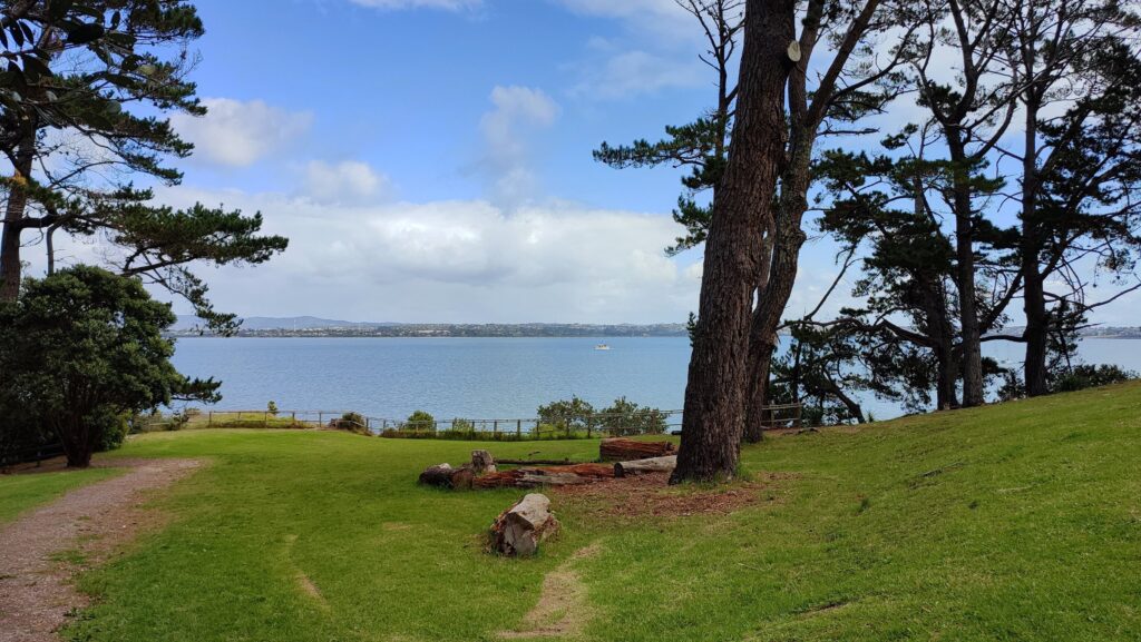
After a short climb up we arrive at an open viewpoint – to the left there is a steep concrete path down to the beach itself.
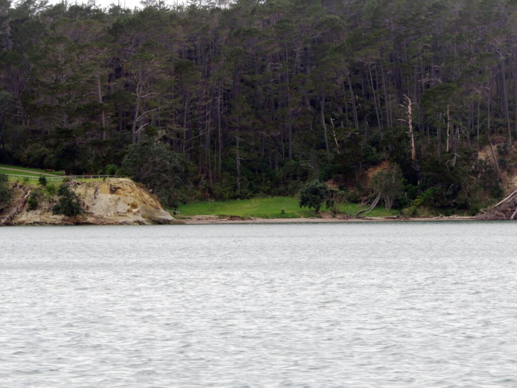
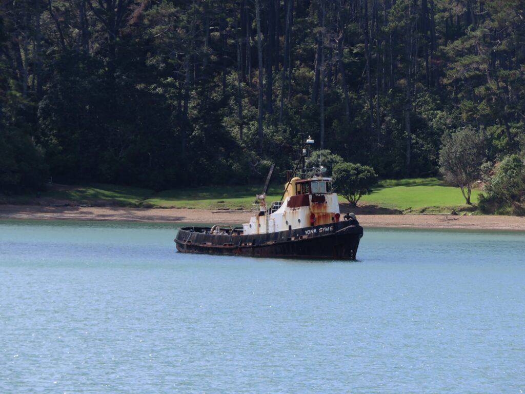
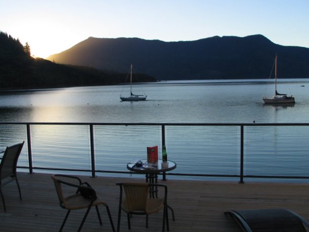
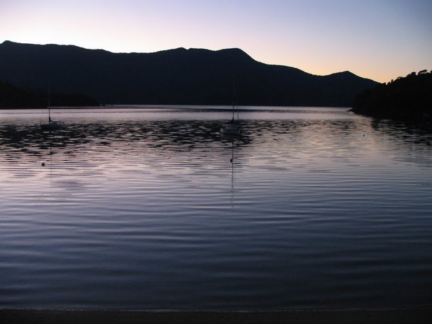
There used to be a derelict tug on a mooring just off Fitzpatrick Bay –
The derelict 61 year old tug “York Syme”, as seen from the Hobsonville ferry – Built in 1961 by Adelaide Ship Construction to a Burness & Collett hydroconic hull design (which is a series of hard chines rather than a smooth curve). Caught fire 6 Feb 2020 while moored in Soldiers Bay. In previous incidents it had run aground in the Weiti River in 2017 and earlier in the Huaraki gulf while towing a barge in 1997. The tug was scrapped by the harbourmaster sometime in 2022-2023
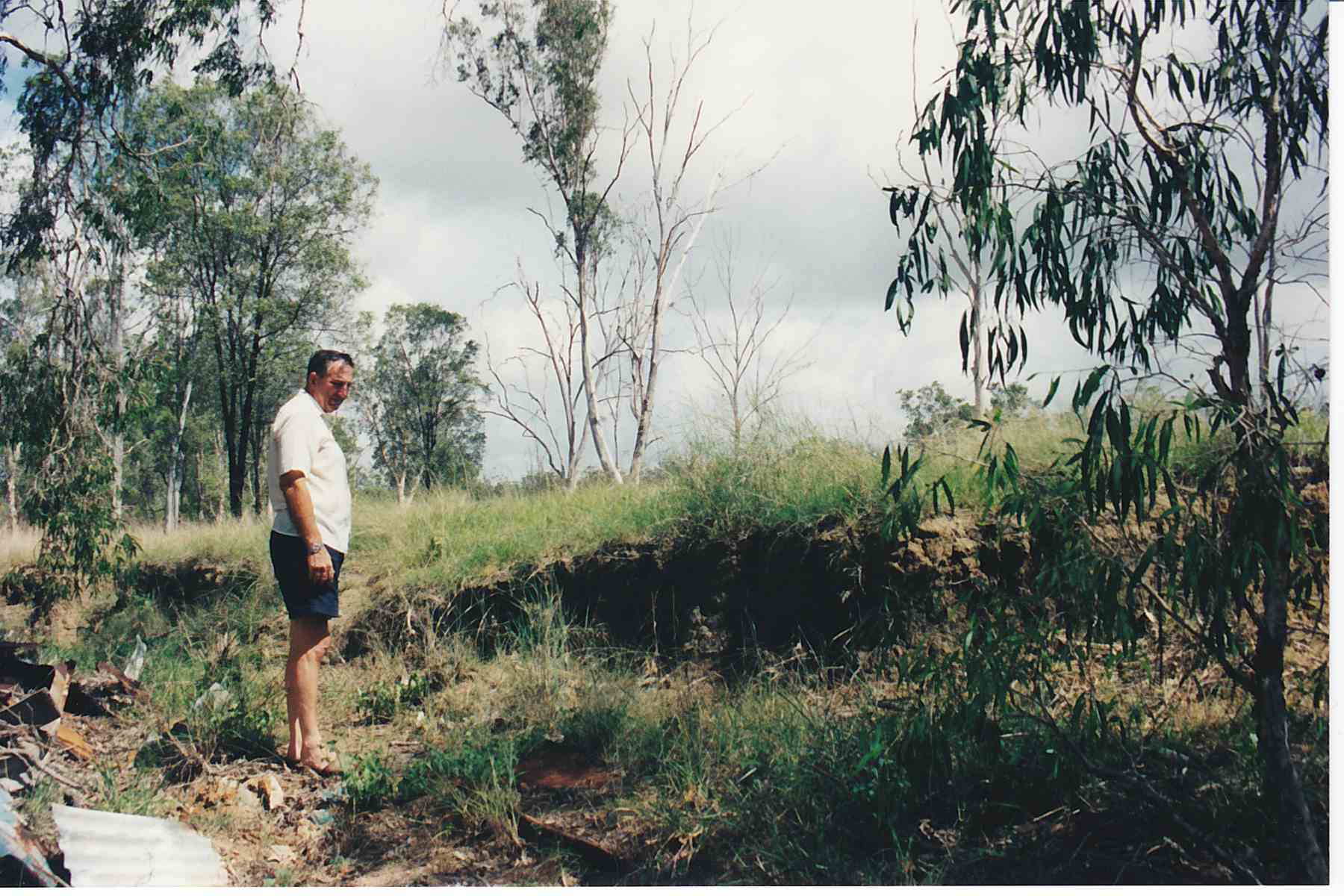
My dad died earlier this year, which left a large hole in my life. I was fortunate to be able to spend some time with dad, travelling on various trips through Australia and Asia. In 1998 we flew over to Brisbane, on a trip to see dad’s ailing sister in Gladstone. This is the story of that trip. Dad’s brother Peter and my cousin Stephen came with us.
Background Dad’s family had emigrated from the UK to Australia in January 1951 on the P&O Cameronia. They first settled in north-west Queensland on the railway at Wammutta near Cloncurry. They lived there a numer of years before moving out to the east coast on the railway at Kooltandra near Ogmore. On this trip we would revisit Kooltandra, and also find my grandfather’s banana plantation he walked away from during the great depression.
Day 1: Brisbane – Kingaroy – Bundaberg
Bunya Mountains National Park
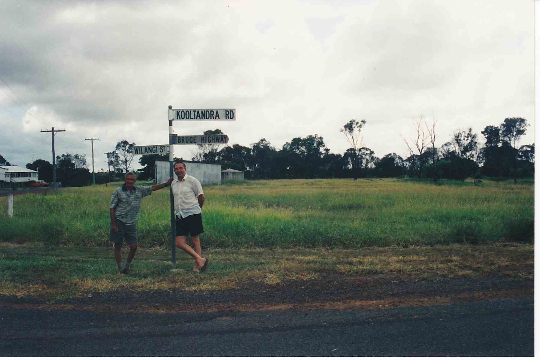
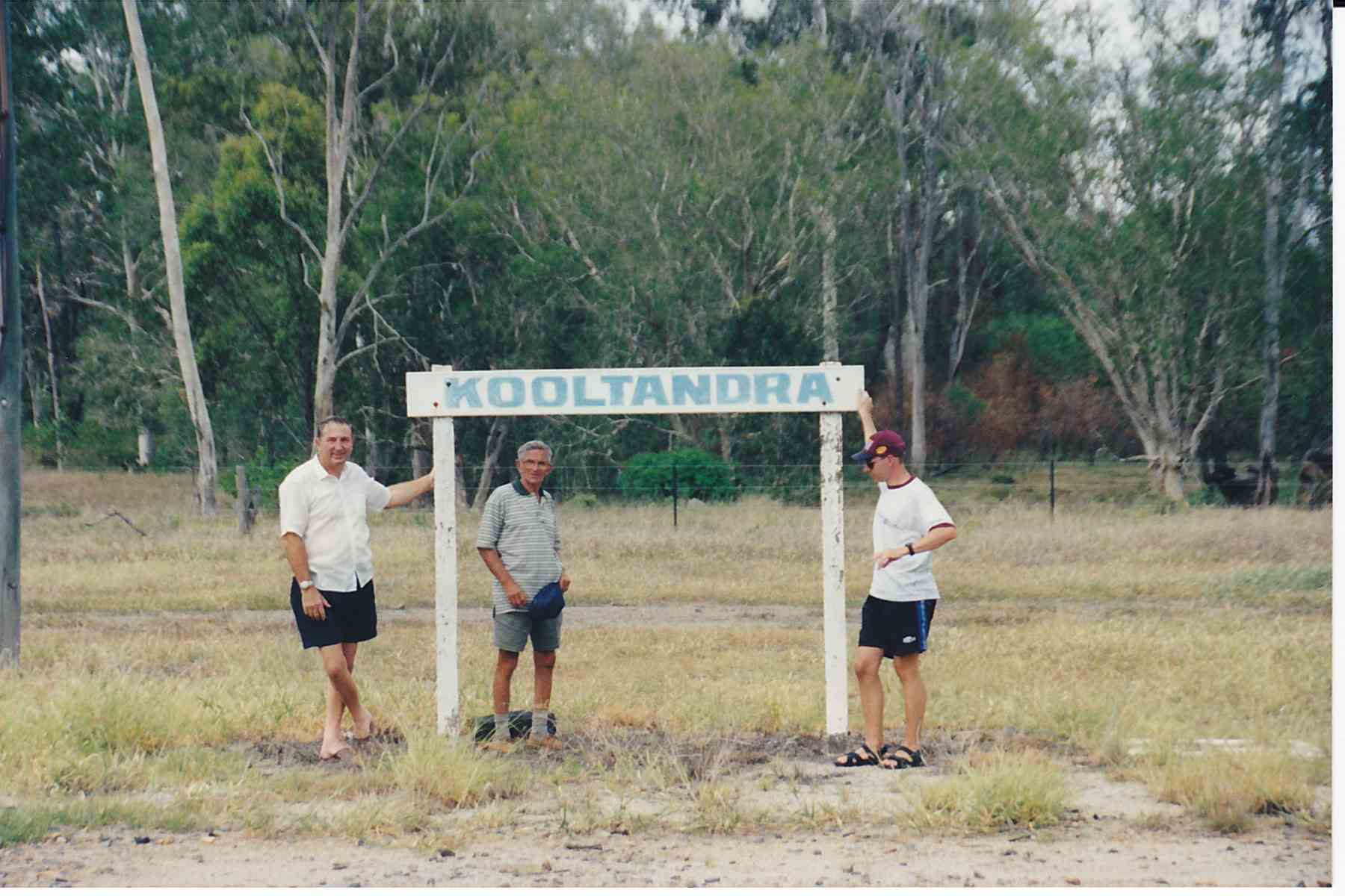
Day 2: Bundaberg – Mackay We pulled off the highway at Marlborough for a drink and decided to hunt out dad’s old place at Kooltandra. Further up the highway we stopped in Ogmore and found the site of the movie theatre where dad worked. We followed Kooltandra road through the scrub for a couple of kilometers south.
Peter (left) and dad at Ogmore
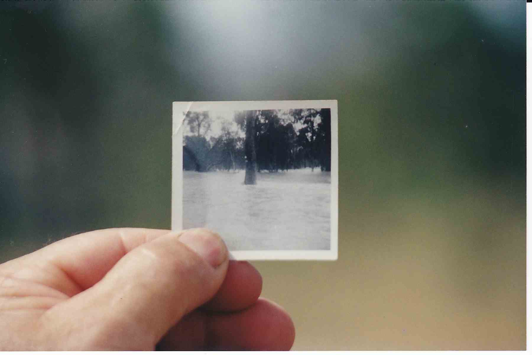
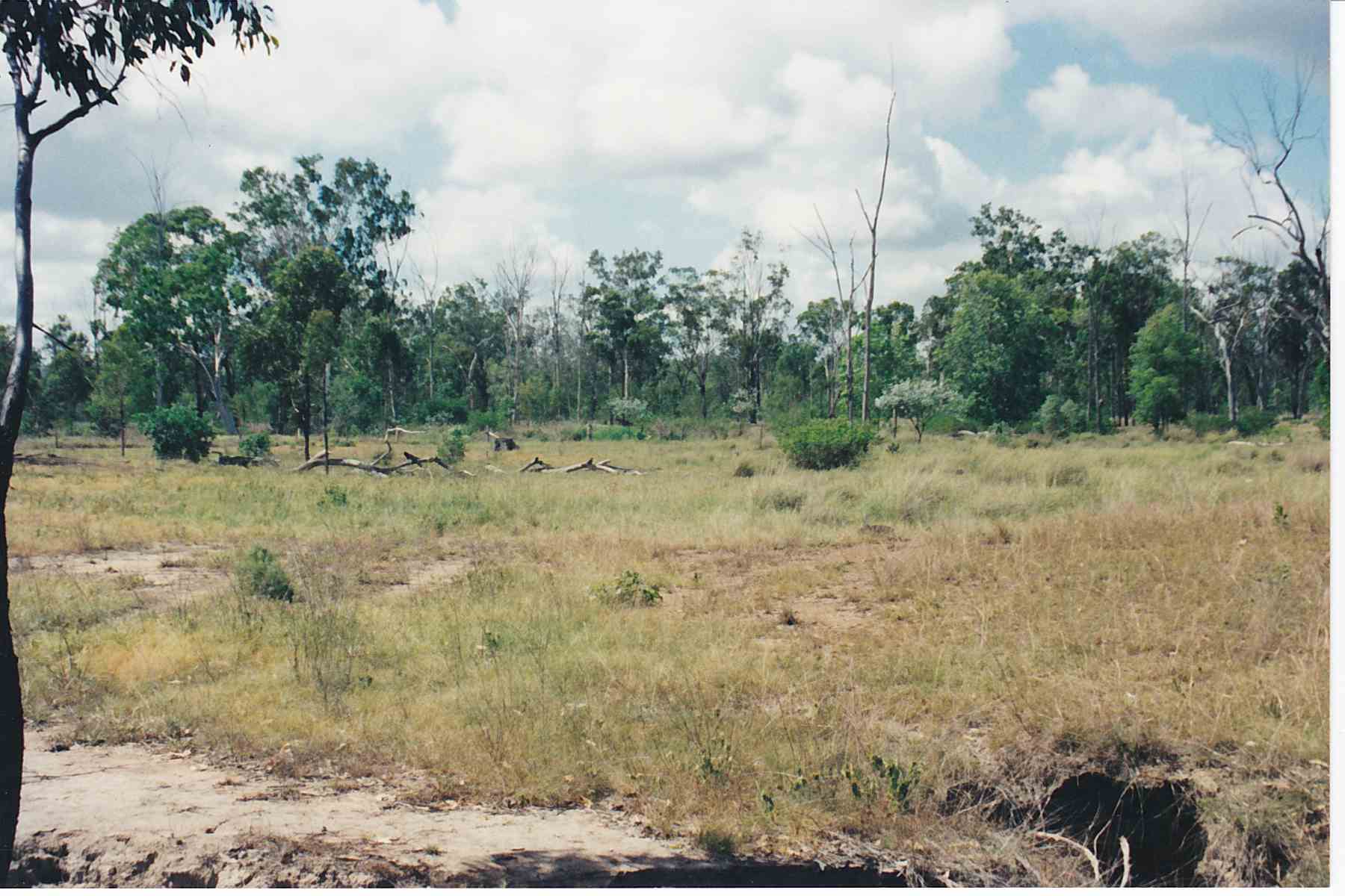
There was nothing left except for a wooden ‘Kooltandra’ sign and some railways infrastructure. Dad was able to point out the stump of a tree that he had a photo of surrounded by floodwaters.
The old photoThe tree in the old photo is the stump left of centreKooltandra, no station here anymore
Dad also spent some time poking around in a gully where a firearm had been dumped that had been given to him as a kid. No hope of finding it after all these years.
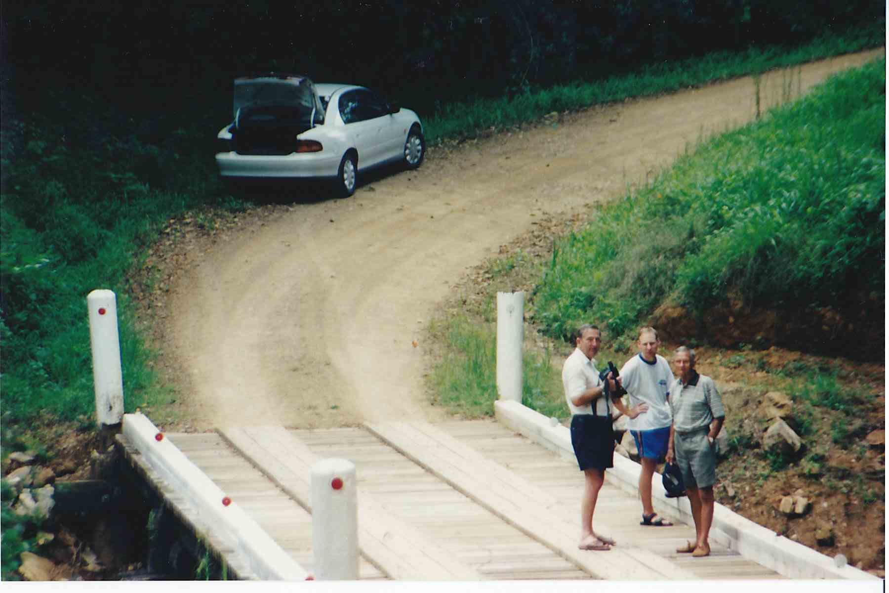
Day 3, 4, 5: Mackay, Broken River, Brampton Island
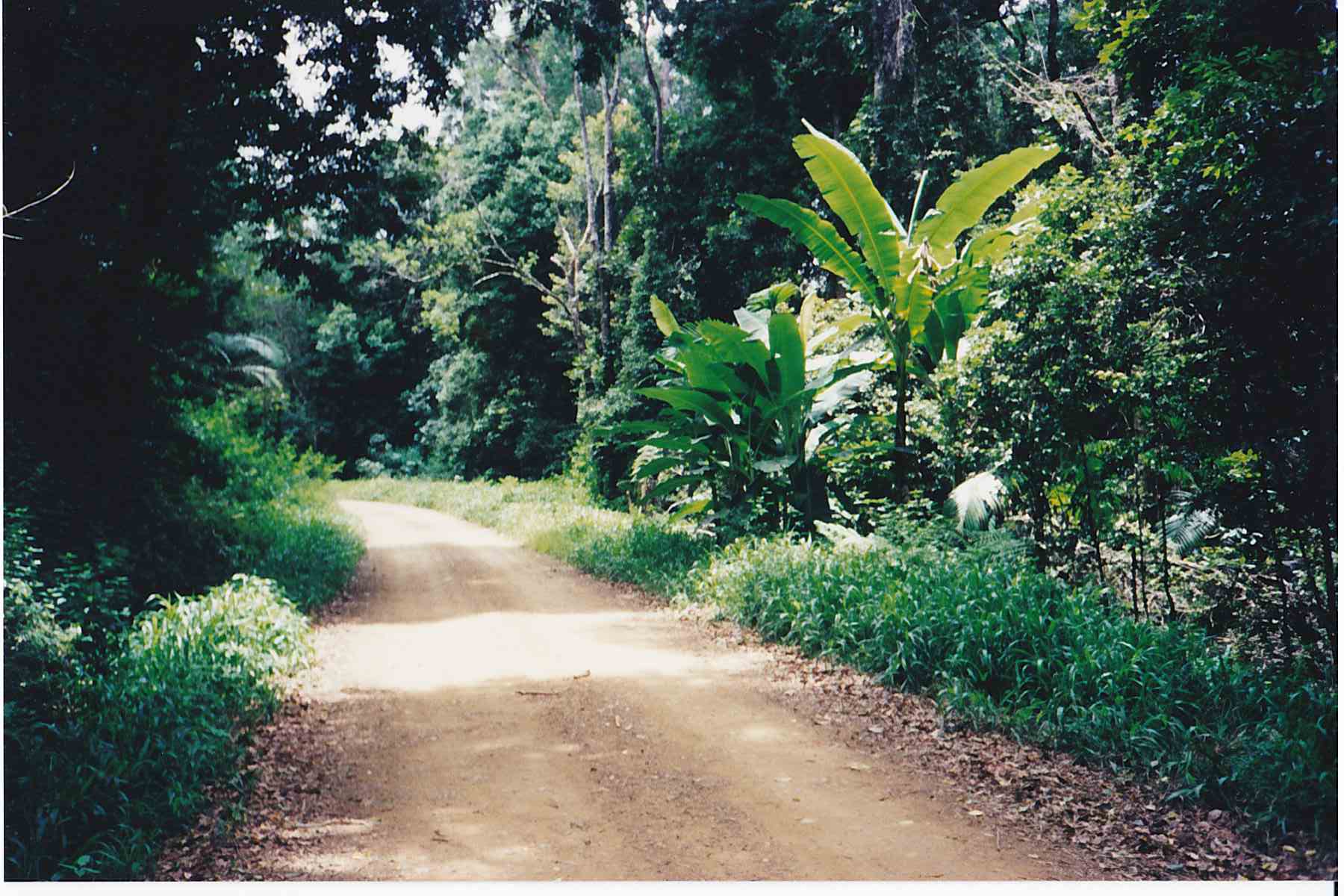
We spent a few days knocking around the area. My grandfather had a banana plantation somewhere near Eungella, so we set out to see if we could find it. A local museum gave us a few tips where some wild bananas grew within the Eungella reserve.
Possibly the site of Grandad’s banana plantation, now part of the Eungella National Park, near Broken River. Possible location on Crediton Loop Road.Eungella National Park – possibly near Lex Creek Road off the Crediton loop Road
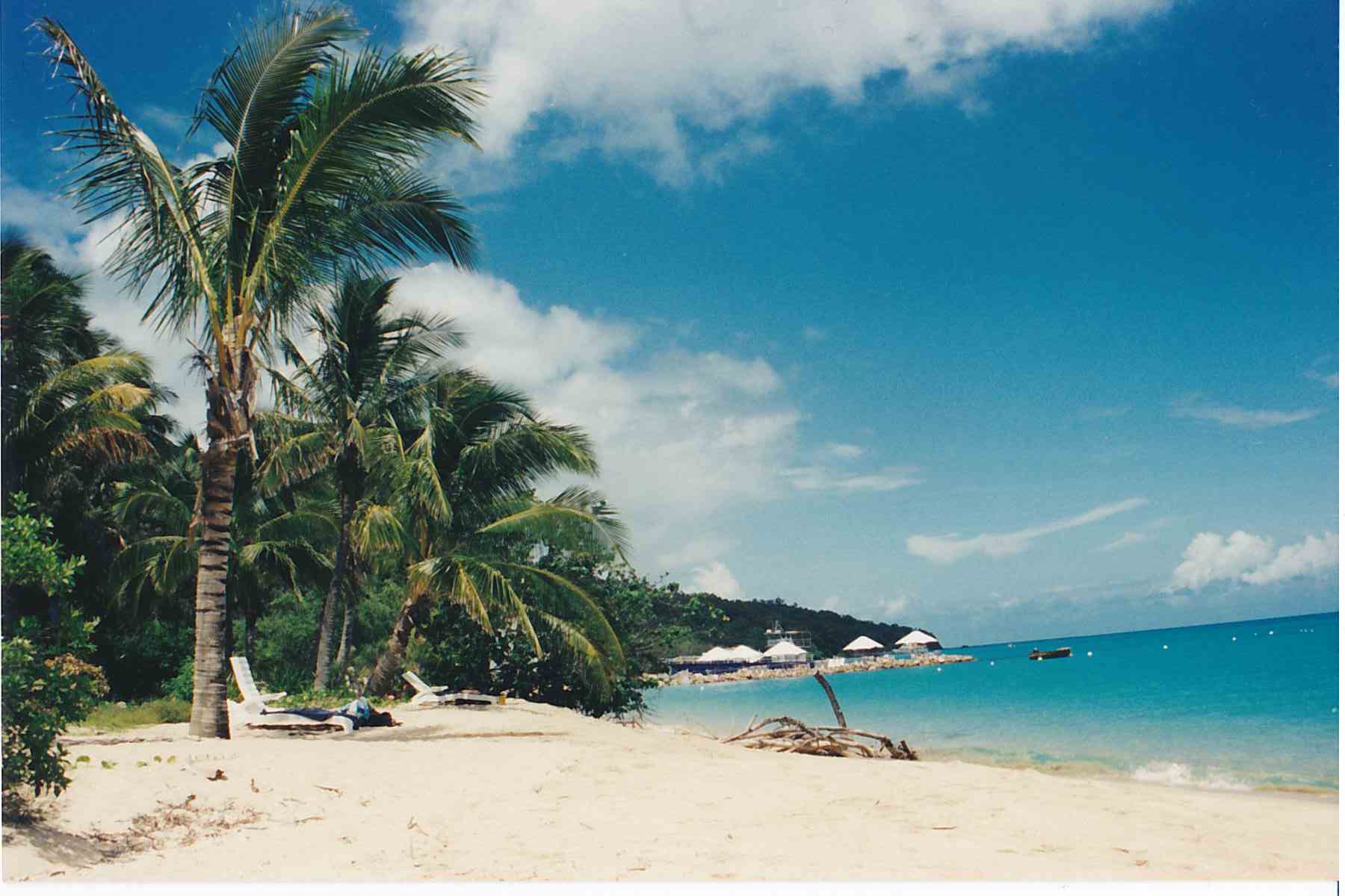
On a spare day we caught the boat out to Brampton Island for a look. It was still a busy resort with a nice beach. A couple of years later mum and dad spent a week on the island for a holiday. In more recent times the resort has closed and has been abandoned.
Brampton Island in the Whitsunday Islands, now an abandoned resort
Day 6, 7: Mackay – Gladstone Capricorn Caves at Rockhampton
Day 8: Gladstone – Noosa Epic thunderstorm in Gympie and Noosa On the drive south, we got caught up in an epic thunderstorm as we headed through Gympie, the driving conditions were pretty difficult in the ultra heavy rain. Later on we stopped in Noosa for the night, I walked down the street and spent an hour or two watching the anvil crawling lightening, with what felt like dozens of other people.
Years ago, I was travelling back to Auckland from Nelson after spend a day in one of the local stores sorting a stock issue. It must have been around 2001 or 2002.
In the golden light of the late afternoon I fell in love with Nelson. The day hadn’t been the nicest, but now the sun was out, it was warm and beautiful.
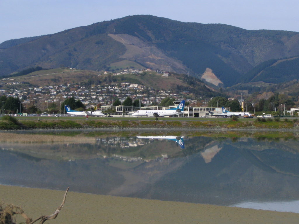
Nelson Airport c 2006
Back in the day Air NZ played New Zealand music pre-flight, and as we sat on the tarmac Anika Moa’s ‘Falling in love again’ came on. It stuck in my mind, synonymous with Nelson, and quite a few years later we used is as part of our wedding music selection.
We have been able to travel to Nelson a couple of times as a couple, and later on as a family. Special place, special memory.
Background – this is a story I wrote up on Vorb in 2006, I thought it would be good to dig it out and share it with a wider audience GW 2019
. . . . . . . . . . . . . . . . . .
And so it all began, I was aiming to fly into Nelson from Auckland on Origin Pacific.
Lesson #1 – the bike is included in your baggage allowance which totals 15kg. $5 per kilo for anything over. Total checked baggage (including my bike) was 35kg. I was let off $70 lighter
Just as we took off from Auckland, a child a couple of seats ahead of me threw up. The cabin was filled with a smell that terminated any hunger pangs I may have been having at the time. The rest of the flight was pretty sweet until the approach into Nelson which was very rough with a very strong crosswind – shades of Wellington style landings :hmmm:
After landing I gathered my gear and dragged it all over to the Air NZ terminal where the rental agencies were. No dramas getting the car sorted, but lots of dramas getting it all to fit in!
I stayed that night in a cabin at the Top 10 campground in Motueka. Top 10 campgrounds are usually pretty good with clean facilities so that’s why I prefer to stay in them, less chance of getting attacked by a mutated shower curtain.
I had a quick spin on the bike around the back streets of Motueka the next morning before pointing the car inland down the Motueka Valley Highway – it was very picturesque.
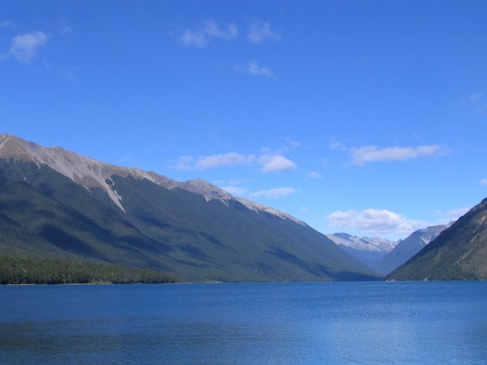
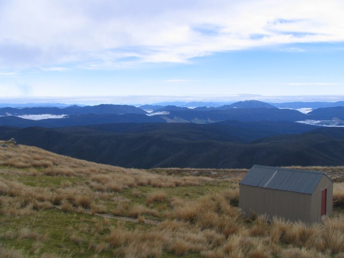
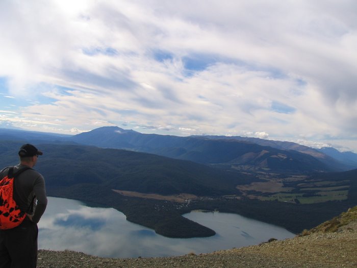
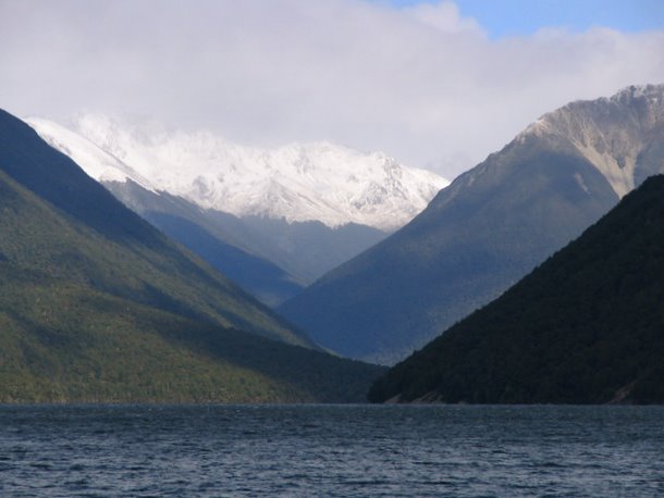
St Arnaud, Nelson Lakes
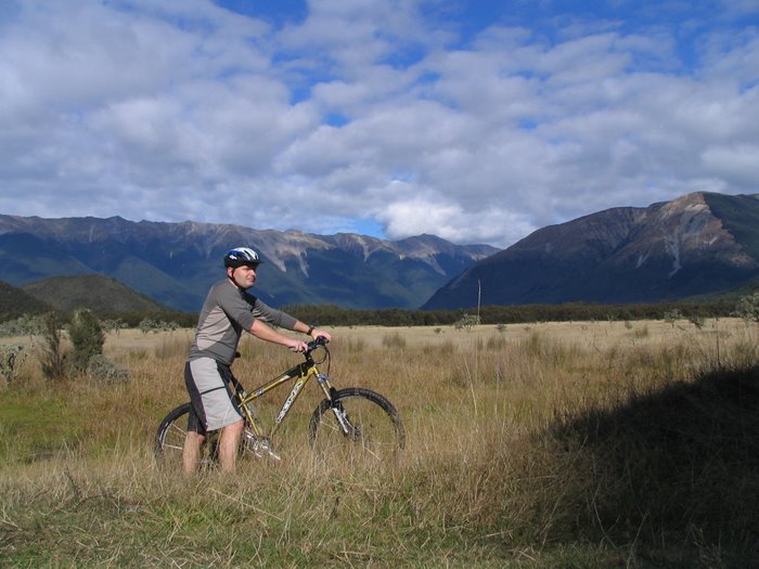
After checking into the motel in St Arnaud, I put the bike together again and headed out to the Teetotal flats MTB tracks. DOC have put these tracks together around the old Teetotal road. I rode around for a couple of hours initially on the loop track, but then started following random sheep tracks. I got pretty wet fording some of the streams and swampy bits. Otherwise it was well worth it.
Teetotal tracks, St Arnaud, Nelson Lakes
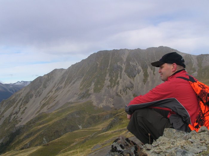
The next day I threw some lunch and a drink into my Pikau and headed up onto the tops for the day. The motel owners suggested driving up Mt Roberts to the top carpark and walking from there – it was a very quick way to gain altitude. The walk up through the beech forest was great, as I climbed I could see the Murchason valleys etched with fog.
Once up on the tops I headed for the ski field and the ridge line above it. There was a fair bit of cloud around which made it pretty cold at times so I ended up wearing my Krank jacket – yet another use for it!
I sat on a mountainside with peace of mind and vision clear
walked for days with no-one near
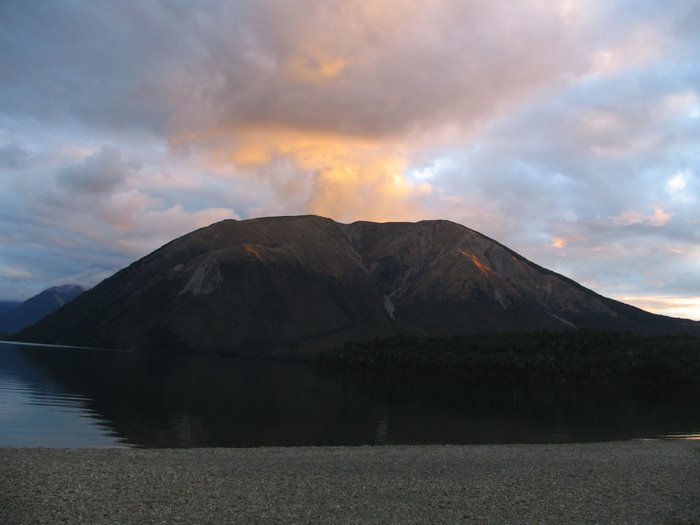
After a great day on the tops I returned to the carpark in the late afternoon. I picked up a 6 pack of beer from the shop but was too tired that night to even drink one.
Sunset on Mt Roberts, Nelson Lakes
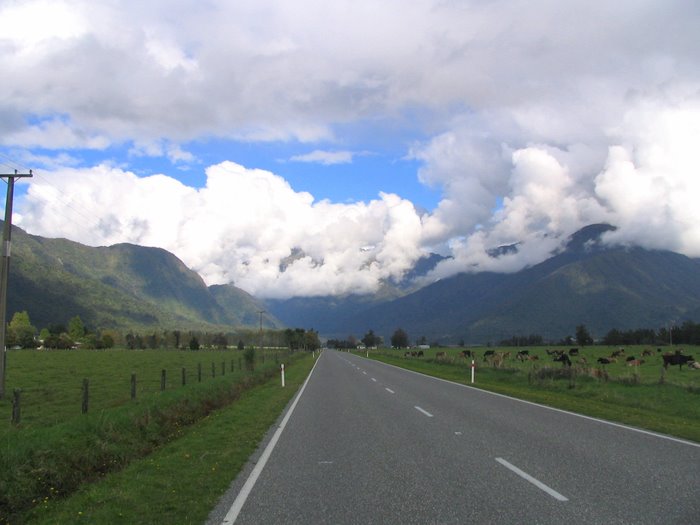
Next day I headed south to Fox Glacier. The day was one big blur of driving. I managed to get the rental car down to 9.2 litres per 100km, which was essential given the arse reaming petrol prices on the west coast.
State Highway 6, West Coast
I dodged rain all the way from Greymouth south, it was freezing cold everytime I stopped to take in a view or to have a leak at the roadside.
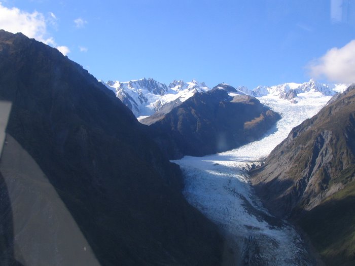
The next morning dawned fine and clear – I’d splashed out and booked a heli-hike on Fox glacier today and I’d been praying for fine weather.
Lesson #2 – they will let you take your own boots if you want, instead of wearing the ‘loaners’ they have for punters. I then wished long and hard for my Merrells which were safely back at the motel.
The helicopter flight up the glacier was nothing short of brilliant.
Fox Glacier
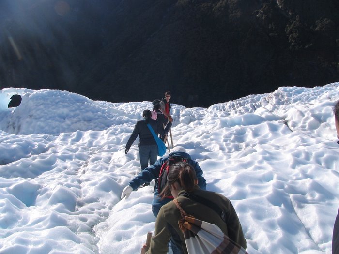
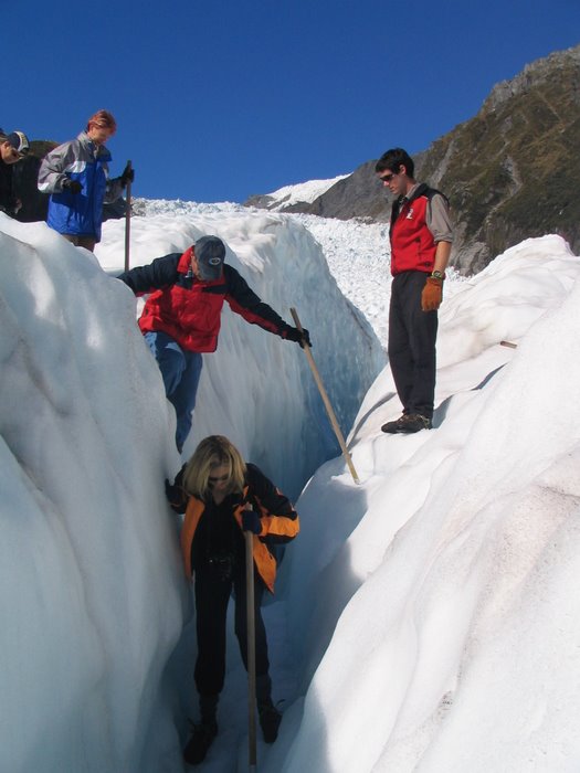
After checking out the top ice fall and the spectacular Victoria falls we landed on the ice and joined the rest of the heli-hiking groups that had been ferried up the glacier. We were given crampons and an alpenstock (stick with a spike on the end) and instructed how to walk.
The woman in front of me was one of those people who never listen to instructions so I spent much time waiting while she got stuck climbing up ice steps and falling down holes. At the first chance I jumped ahead of her and instead got to follow a pretty South African woman. Much better.
We saw ice caves, crevases, waterfalls, cracks, ice, and ummm ice. All in all it was an awesome way to spend a couple of hours. Talking to the guide later he was saying that very few New Zealanders go on these trips (I was the only kiwi in the trip of 33, made up of 3 groups with a guide in each group) It was so worth it!
The flight off the glacier was less spectacular – flying down the other side of the valley back to Fox township. Back at the motel I put the bike together once again and went out for a lazy spin down the road. I was rewarded with some great views of the glacier and southern alps.
Another day of driving was ahead – I pointed the car south from Fox Glacier and headed down State Highway 6 to Haast. I stopped in Haast to stretch my legs, buy a pie, and laugh at the petrol prices on the pumps at the petrol station (last petrol for 120km for those heading north)
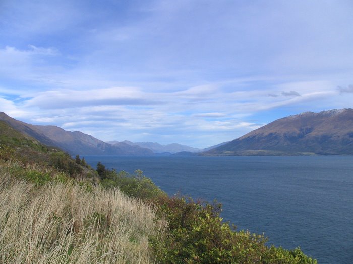
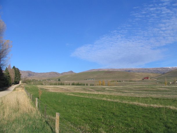
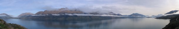
Once over the Haast Pass, the road dropped into central Otago. The sun came out, the road was dry and the views of Lake Wanaka and Lake Hawea awesome.
Wanaka is always a great place to go – no crowds of people to push through, good pies available, and a great lakeside beach on which to sit and eat pie and people watch. After lunch I fueled up the car and headed south to the Top 10 campground at Cromwell.
The plan the next day was to ride the lakeside tracks in Wanaka – another awesome day was on the cards. The first track I took was the Glendhu Bay track, it climbed above the lake and gave brilliant views back over Wanaka.
There were quite a few walkers on the track but I had no issues with them. I retraced my tracks and then onto the other half of the Lakeside track and then Outlet track. These tracks were more ‘bike friendly’ and I was able to rip along at a fair speed, only problem was I was stopping every couple of hundred meters to take pictures.
Rather than ride back into Wanaka via the road, I did the track again. What a great place Wanaka is! I spent the rest of the day in the Wanaka toy and transport museum and also the Warbirds museum. The toy and transport museum is wonderfully chaotic and interesting – if only I’d saved some of the toys from my childhood!
The next day was another cracker day – the first day of the duck shooting season, so while I was putting my bike together at the bottom of the Thompson Gorge Road the boom of shotguns echoed around.
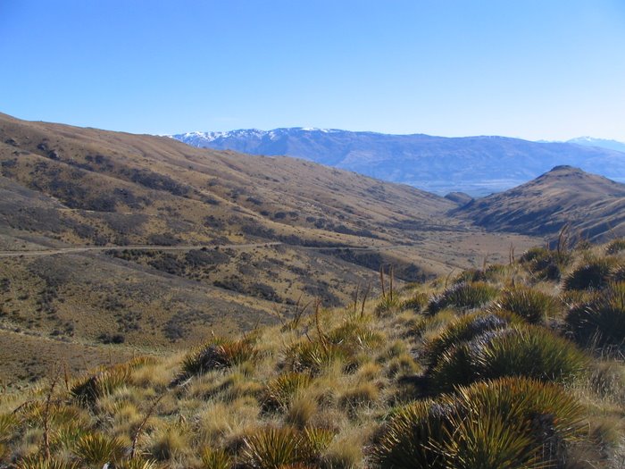
The ride up Thompson Gorge was great, in hindsight I stayed too long in the middle chainring so I got poked very quickly. It was around 13 km of uphill, I ended up pushing the bike up a fair bit and riding the rest. The Dunstan Range is great – behind me open views of the Wanaka region appeared. Ahead of me was yet another section of gravel heading up into the hills.
Near the saddle I could see the snowline a couple of hundred meters higher up on the flanks of Mt Moka. I can do that! I thought. I pushed the bike up for about an hour or so – I found the snowline was just a bit off the track so pushed my bike through the speargrass to reach the snow (yeah it was first time in speargrass… more later…)
After a while I carried my bike back to the track through the speargrass, found a rock to sit on and set about fixing the puncture. I had only one tyre lever and a spoon so had a bit of a mission getting the tyre off the rim – at least I had great views and a fine day.
The ride back down was great, 13km of downhill. I had to keep the bike speed fairly low as the back brake pads were really hot and protesting loudly.
About half way down I lost pressure in my back tyre again – strike another victory to the speargrass. I managed to brand myself with the brake disc – making a nice mark on my leg and filing the air with loud swearing. I stuffed another tube in, inflated and continued down. Got back to the car in the late afternoon. What a great day!
Next day I had penciled in to ride the Nevis Valley (or at least up to Duffers saddle) but my knees were still giving me heaps, so decided on a rest day.
I headed out to the Bannockburn sluicings and the old buildings at Stewart Town, quite an eye opener given the massive landform modifications done by the sluicings.
After spending a couple of hours wandering around the sluicings I got the desire for a spin on the bike. I chucked the bike in the boot of the car and headed south to Clyde to the start of the Otago Rail Trail. The section between Clyde and Alexandra is reputed to be pretty boring, but it was flat and wouldn’t give my knees too much grief.
The 8km or so didn’t take too long to pedal, but took a fair amount of time as my rear brake pads were rubbing something chronic and I stopped a couple of times to have a go at fixing them.
I decided to cut back to Clyde via the Alexandra – Clyde riverside track, good decision. Close to Alexandra there were quite a few walkers on the track and I had one or two times where I had to give way on some of the bridges. As the track progressed it turned into some nice singletrack. I managed to crank along at a fair pace and loved the flow of the track.
At the Clyde end of the track I was tempted to turn around and ride the track again, but the late afternoon light was fading fast.
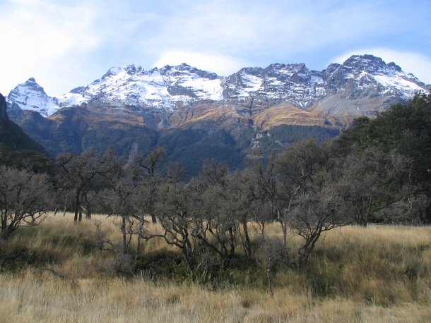
My knees were feeling heaps better the next day so it was back on plan for the riding. I drove out through Queenstown to Glenorchy. This is one of my favourite roads on the planet because of the views.
I stopped at Glenorchy for a well earned pie, and then continued north to Paradise (yes that is the real name of the place) at the bottom of the Dart Valley. I parked the rental car just before the first ford crossing and put the bike together. There was a bitter cold wind and quite a lot of cloud around so it wasn’t too warm.
I pedaled through the ford and managed to keep my feet dry. The road to Chinamans bluff is pretty easy riding, though with all river valley rides has a slight uphill slope which doesn’t appear to be uphill. The gravel road curved around through open grass land and classic South Island beech forest.
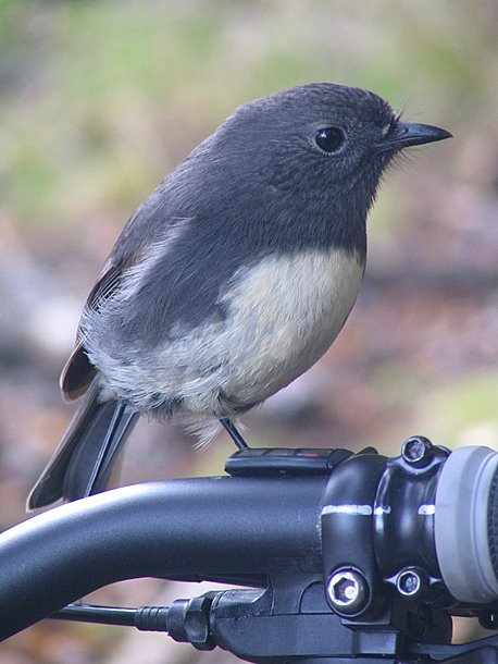
I stopped in the forest for a break – sore knees again – I discovered my seat wasn’t at my regular ride height, a couple of cm too low. While I was adjusting my seat, a little Robin flew up and landed on my bars – totally unafraid of me. It started pecking at my brake levers, and finding no nutrition there moved onto the computer.
I continued out to the car park at the road end, I had managed to beat a car load of tourists who had started the road at the same time as me – at each ford they all had to get out of their Subaru wagon while the driver inched through. Once I’d stopped riding I was freezing cold, I put on all the gear I had and sheltered out of the wind to eat lunch.
The following day was an easy day on the Otago rail trail – initially in my trip planning I’d set aside a couple of days to ride about half of the trail between Alexandra and Ranfurly. I truncated my plans and decided to ride just a small section instead from Ida Valley to Wedderburn and back again.
She was a pretty cold day with a bit of a headwind to ride into for the first half of the ride at least. The track had a very slight upwards slope (damn hills!) but I was able to ride along in the middle chain ring no worries.
The Ida Valley – Wedderburn section offers a few distractions
The highest point on the trail
And also a couple of crossings of the 45° south latitude line
I spent a long time at Wedderburn getting the famous goods shed on camera as well as the old railway station. I stopped a couple of km further down the track for a feed sitting in the sun.
While I was sitting on the side of the track, a couple of groups of riders came through – they were on some crusty rigid bikes from the previous decade, and having a hard time of it, some of them were pretty unfit with beet red complexions – could have been the many layers of woollen clothing they were wearing maybe? They didn’t seem to be having a good time, I wondered if they would enjoy some tasty single track instead?
From the highpoint on the trail I amused myself by attempting to not pedal for the rest of the track back to where I’d left the car. I managed a couple of km before boredom took over and I climbed into the large chain ring for a quicker ride. In hindsight if I set out to ‘do’ the trail in the future I’d do it in two halves; Wedderburn to Alex, and Wedderburn to Middlemarch… I’m all for gravity assistance!
The rest of the day was spent in an elusive search for a good pie before returning to Cromwell for the night.
I headed north the next day, up state highway 8 from Cromwell to Omarama via the Lindis Pass. The weather wasn’t the best, with vast amounts of low cloud ‘pouring’ through the pass itself. I couldn’t find the enthusiasm to stop in Omarama for the night, nor Twizel. I normally love small town New Zealand but just couldn’t find any ‘spark’ in these places.
I parked up in Twizel, leaving the engine running and the heater on… flicking through my trusty AA accommodation book…. hmmm…. how about Mt Cook? Yeah my Visa is still healthy and it’s about time I stayed somewhere where I didn’t have to provide my own bedding. Made a phone call to make sure, and I had a chalet for a good price. Happy happy joy joy!
As I left Twizel, the sun came out which I took to be a divine sign I’d made the right decision. The drive along Lake Pukaki was great – the brilliant blue of the lake reflecting up into the remaining clouds making them a whacked out blue colour.
Ahead awesomeness.
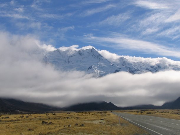
I checked into the Hermitage You want how much for a top floor room with a view???! and was given the key to a chalet… blown away to find it was one with a primo view of Mt Sefton – below is the view out the lounge window
I pushed the sofa around in front of the window and cracked open a beer to celebrate my good fortune as I admired the fine view.
Later on I got into the swing of things living the high life in an alpine resort. I repaired to the new ‘Old Mountaineers cafe’ which has much fine coffee and huge windows looking straight up the valley to Mt Sefton and Mt Cook.
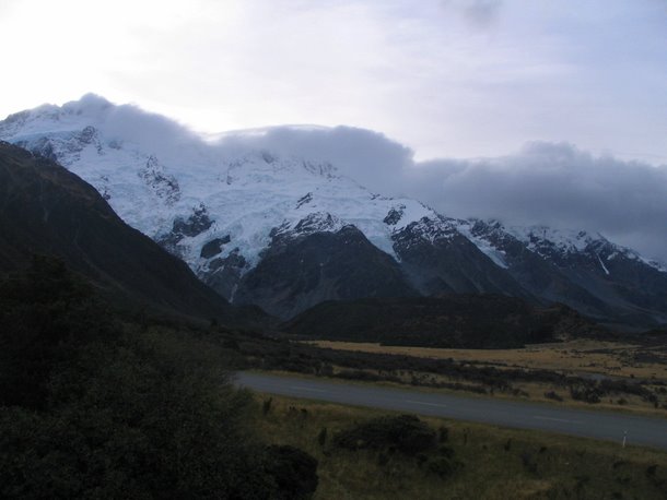
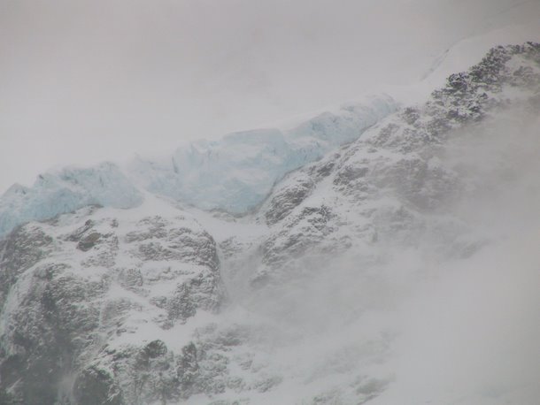
A massive mild dose of caffeine inspired a walk out to Kea Point. It was well worth it – the face of Mt Sefton was awesome close up. The whole place boomed with cracks and grumbling noise from ice on the move. I felt sorry for all the tourists on their air conditioned tour buses who wouldn’t walk the short track up there… their loss, my gain. I had the place to myself for an hour almost before I saw another person.
I enjoyed the sunset back at the chalet – I watched as the white snow turned to grey, then black. As I lay in bed later, I could still hear the cracks and booms from the ice, ever shifting up the valley.
I woke to rain… lots of it. The deal with the chalet also included breakfast at the Hermitage, so I high tailed it up the road for some free scoff. The breakfast menu reflected the target market for The Hermitage… Miso soup, noodles… mmm just what I wanted. Lucky they also had an excellent spread of fried stuff… bacon, eggs, toast…
I pointed the car out of Mt Cook and wondered how I could escape the rain. Maybe Tekapo would be dry? There are a couple of huge valley rides near Tekapo so I could stay there a few nights maybe? Nah – still bucketing down there.
Onwards to Fairlie – gateway to the McKenzie country (in my case – the gateway out!) Still raining and I didn’t fancy one of the pies. I pointed the car down Route 72 – the inland scenic route… what scenic?
Rakaia Gorge – the rain backed off a bit… stay here? Nope – nothing in the accommodation book. An idea formed… I’d penciled a couple of days in Hanmer Springs… what if I continued on and stayed there a couple of extra nights? Sorted!
A few hours later I was stretching out my aching shoulder muscles in one of the ‘stinky’ hot pools – man it was bliss after a solid day of driving in the rain.
My first full day in Hanmer was a wet one – the rain I’d driven through the day before had moved up the South Island overnight. I used the day as a ‘catch-up’ day to do my laundry and food shopping. Towards dusk the rain stopped and I was able to get a decent walk in the forest behind the campground before it was too dark to see where the hell I was walking. Another night at the pools.
The second day was fine – a fresh dusting of snow was on the tops, cold and clear. I warmed up with a couple of tracks in the forest, then pedaled out of town on the Jacks Pass road, turning at the ski field sign and heading uphill.
After a minute or two I was in the small chain ring and approaching granny gear fast. I figured I’d have a better chance of ‘twiddling’ my way to the top slowly than rushing up there in a harder gear.
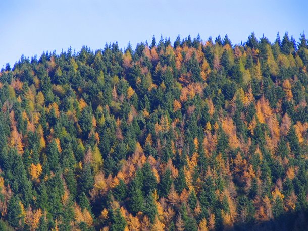
As I twiddled uphill I was passed by a bit of traffic – a panting jogger and a car load of tourists. I met the tourists again when they were executing a 37 point turn trying to turn around and head back. Ha! Fools! The pass was just around the next turn and up a bit! I also decided I’d have a go at planting some larch on the family farm in Auckland – I loved the ‘random’ colouring larch gave the hillsides.
At the top I debated turning around and ripping downhill back to Hanmer, but a little voice inside my head suggested going ahead and riding down to the Molesworth. I had all my warm gear on and was still freezing which was my main concern. Alongside the road the water was frozen in the drains and this Aucklander was easily amused by trying to toss larger and larger stones onto the ice without breaking through.
I was blown away with the views as I reached the Clarence River – it was just … fantastic… words don’t really do such a place justice
Who would not be tempted to pedal off into the distance here?
I continued along the road for around 10km until it reached the turnoff back to Hanmer over the Jollies Pass. I rode up to the pass (it was really easy, hardly uphill at all). I got to the top and thought–bugger it. I turned around and rode back down to the Clarence River and rode the road back almost as far as the Jacks Pass turnoff. It was just an awesome place to be and I had no reason to rush and leave it.
I found a nice hillside in the sun and sat and ate lunch. I doubt there was a happier person in New Zealand at that time! I ended up spending a couple of hours in the valley enyoying the views and serenity before pointing the bike back towards Jollies Pass.
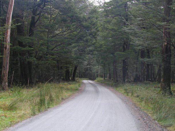
The downhill road from Jollies was a ripper – I was in one of those ‘grooves’ where everything went right, the bike sliding around and skipping under hard braking, but never getting near tipping me off. Between Jollies Pass rd and the campground was a forest riddled with tracks – I made the most of them in the afternoon until the light faded.
The tracks would be best described as beginner level tracks, but they flowed well and what really did it for me were the autumn colours in the many different species of trees that were planted there. The riding surface was a real mixture as well – it ranged from hardpacked gravel through soft leaf litter through mud. After spending alot of time riding in my local Riverhead forest back home, I was surprised that the puddles had bottoms and were ridable without sinking up to the hubs
I came upon some classic ‘European’ style forest views – I’m sure I had picture books as a kid with such images!
Day 15 of the trip looked pretty clear at dawn… after a full breakfast of ‘Up and Go’ and toast I dropped into the bakery in the main street for a pie and a coffee. I enjoyed sitting in the window looking out at the freezing tourists outside… I’m indoors, eating a pie, and guzzling a coffee… ha!
I filled my camelbak with water and a good measure of raspberry cordial to take the horrible taste away. I grabbed the Hanmer MTB trail map and headed for the hills… but first having a warm up blat through the forest behind the campground.
I pedaled the Dog Stream track (good if you like bees) Timberland trail, Majuba (the track goes real close to some of the ‘walking only’ tracks so I got the evil stares from the pedestrians – ‘Go and polish your souvenir Glockenspiel, sunshine’ I muttered under my breath)
As I started Yankee Zephyr it started to rain… and got freezing cold Yay! I followed the forestry road downhill, expecting to get back on the road that headed to the campground. Near the bottom I was greeted with some more signs with pictures of mountain bikes in a circle with a line drawn through them. How do I get out of this place!!?
I jumped off and pushed my bike a couple of meters until I recognised the start of the Dog Stream Track… what the? I figured there was some dim bulb putting the anti bike signs up for fun just to make life difficult. I ended up peddling the Camp Track and exiting back out onto Jollies Pass Rd. A quick spin through the rain (and bits of hail) to the campground and my cabin.
Thinking about it later I thought how few walkers I had seen around the tracks in Hanmer, and how many people were out on their bikes, it was at least 5:1 in favour of the bikes.
The rest of the day was spent indoors warming up, and looking at the rain and hail outside. I cleaned my bike inside the cabin using hundreds of meters of toilet paper Gee this guy must have had some serious dysentery the cleaning staff would have said after I left…. 3 rolls of paper a day!
A last night in the hotpools.
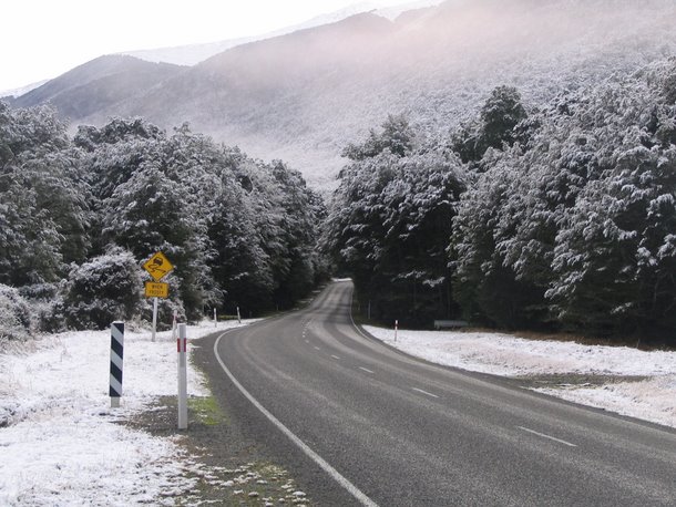
Day 16 dawned clear and cold. Snow on the tops overnight made for nice views around the place.
I turned up the heater in the car and headed west towards the Lewis Pass. The cold snap had left snow down to about 460 meters so there was a fair bit of the white stuff around on the drive.
I stopped at the Sylvia Flats hotsprings to dip my toes in the water. Just in case anyone is looking for them, head to S42.49035° E172.38672° . They are very close to the road (and not signposted)
Towards the Lewis Pass proper the snow was great – for someone (i.e. me) who hasn’t seen much snow it was fantastic. My camera got a good working out as each bend of the road unfolded.
The strange thing was on the western side of the pass there was a lack of snow, even at good altitude. What was awesome though were blasts of wind that blew great showers of ice off the trees and upwards. I continued onto Springs Junction where I forgot about the location and filled the car with petrol… wince… After damaging my Visa at the petrol station, i crossed the road and damaged my stomach with a pie that was internally heated to 200°C
Gasping, I left for Murchison. As the road straightened, the sun came out and radio stations started re-appearing on the car radio. Even the hits of the 70’s 80’s 90’s and today sounded ok after a few days of listening to nothing but static.
I rolled on through to St Arnaud and stopped for some food at the shop. A coke and a muffin accompanied me to the lakeside where I sat in my warmest jacket with little ‘flurries’ of snow flakes around. Man it was cold!
I ended up spending the night in Blenheim. My sole criteria on the choice of motel were the words ‘Heat pumps’ on their advert. 30° – take me to the tropics!
Day 17 was another clear day with ice on the car’s windscreen first thing. I left the tropical motel unit and headed out of Blenheim in the early morning rush hour traffic. Most of the traffic was heading south so I had a clear run to Picton and the start of the Queen Charlotte Drive.
Queen Charlotte Drive is pretty good, but it makes you get down on your knees and thank god for the the person who invented power steering. I couldn’t imagine driving it in a car without it!
I drove through to Rai Valley and headed out on an ultra windy road to the highly regarded Tennyson Inlet. The road was insane with tight S bends that had to be taken at crawling pace. At one point the road split in two around a tree! Tennyson was ok, for such an out of the way place, it was very quiet – I’d imagine in summer it would be awesome…. back out on the insane road to Ria Valley and back towards Havlock.
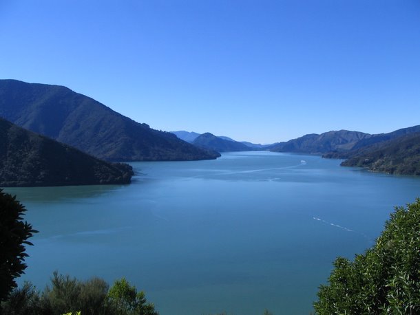
I stopped at a lookout on Queen Charlotte Drive called ‘Lookout Point’ (who names these places??) and had the place to myself while I ate lunch. I guess people passing don’t really think there could be such an awesome view of the sounds so close to Havlock and able to get to it via the car.
I’d read about a place on the internet – it sounded just so great. According to my faithful AA accommodation guide it would cost a bit… no worries, the Visa is still being accepted!
I continued back along Queen Charlotte Drive as far as Linkwater where I turned off and headed out along Kenepuru Rd / Sound. At one point I was waved down by a logging crew who were dropping trees onto the road from a steep hillside. As the next tree hit the ground, I was waved through… I’ve had it all in the South Island, stopping for sheep being moved down the road quite a few times, cattle being moved a few times, and now trees being felled.
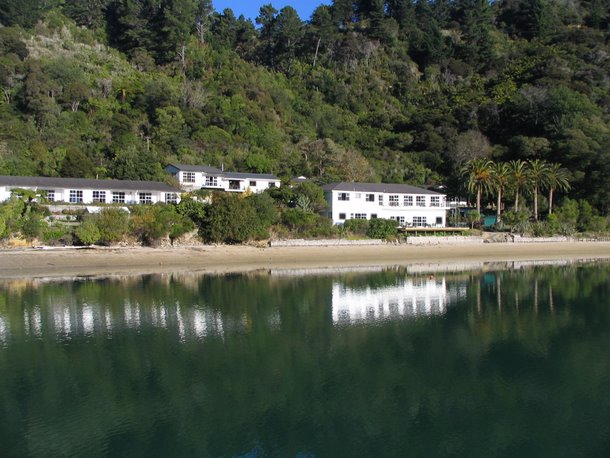
I reached my destination – Te Mahia Bay Resort. My god! What a place! The owners waved me down the drive to a parking spot and showed me the room I’d booked. More like a house! It is a historic hotel that was build in the late 1800’s and added onto in the 1930’s so the place just oozed character. Bakelite light fittings, lights were those pull on a chord type switch. It was decorated pretty good with a few modern touches. No keys either!
I had a bit of a wander along the beach to unwind a bit after the day of driving… there were a few options – my bike was in the boot of the car and the Queen Charlotte track was only about 200 meters away… or my tramping boots were all dried and ready…
I put on a pair of shorts, found my sunnies and hat, and put some beer to chill in the fridge. I spent the rest of the day just absorbing the peace and quiet of the place. From the deck I could lob an empty beer bottle into the tide with no effort I stayed outside in the warm sun until it vanished in the west and the sky turned an inky purple blue. It was more like summer than the second week of May!
The next morning I ate breakfast on the deck, getting maximum value for my ‘investment’. I cleaned up and packed the car, I so didn’t want to check out and head to Nelson. I wanted to spend a week here, damn the expense!
Driving into Nelson was sort of an anti-climax of the trip. My holiday was near the end, my laundry overdue, and a supermarket bag of orphan food items I hadn’t gotten around to eating during the trip lurked in the boot of the car. I checked into the largest campground in the southern hemisphere – I read that somewhere – (Tahuna Beach)
I stopped in at a bike shop to arrange for my bike* to be couriered up to Auckland rather than get reamed and fly with it again.
I spent a couple of hours walking around the golf course and airport walking tracks – hmmm could I get some more time off work maybe? I could get a smaller rental car perhaps and do another lap of the South Island?…
Day 19 dawned fine and clear. With a heavy heart I filled the petrol tank of the car for the last time, crammed my gear in and drove the 5 minute drive to the airport.